From January 2016, the Dutch Weather institute, KNMI, is providing weather forecasts for Saba and the maritime environments as well as warnings for shipping and hurricanes. You can find the links at the bottom right in the the News menu.
The site wunderground.com gives access to up-to-date-weather information and some interesting predictions based on data collected by Personal weather Stations (PWS) all over the world.
The key weather station on Saba is run by Chris Meijvogel in the Bottom. It measures wind speed and direction, temperature and precipitation. The data are send to the servers of wunderground.com who make the data available worldwide, in real time. You can observe the actual weather conditions in The Bottom in real time and dive into the weather history recorded by the station.

The real time summary information is presented on the home page of Saba-News.com at the bottom of the column on the right side of the page.
If you want to see more, click in the link “The Bottom” to access the station information on the Wunderground.com site directly.
On this page Wunderground presents not only the detailed station information, but also satellite and radar pictures.
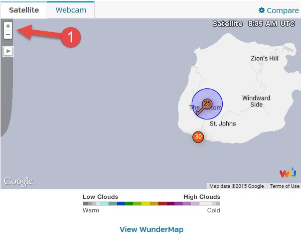
The map shows the two weather stations currently active on Saba. In the blue circle is the station of Chris Meijvogel in The Bottom. There is another station in Fort Bay that is operated by the Saba Conservation Foundation. Unfortunately it sometimes has issues with its sensors, so not always is all data being made available continuously, e.g. the picture shows that no wind information was made available.
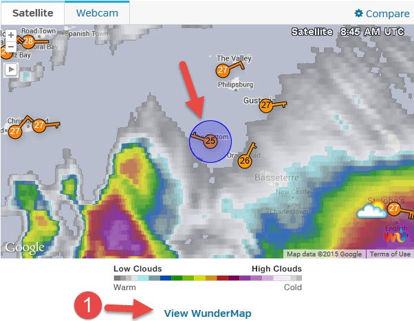
Zoom in with the controls “1” at the top left to get a wider satellite picture. The Saba station will remain in the center of the picture. This results in a picture that depicts the cloud structure of TS Erika, approaching from the east.
To get a better picture of the weather systems in the area, click in the link “View Wundermap”
You are presented with a map with Saba in the center. On this map you can select several overlays from menu (1). The legends (2) explain what you are going to see. You can zoom out with the controls (3).
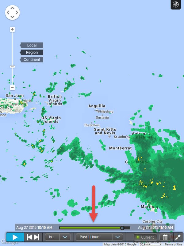
On the “radar” picture below, you can see the current rainfall in the area selected. If you use the controls at the bottom, you can turn the static “now” picture into a time lapse “movie” so you can get an idea about the evolution of the weather system in the past.
This is the weather that was and is, but what about predictions? Wunderground also provides predictions. To get access to these you need to go back to the Personal Weather Station (PWS) information. Click again in “The Bottom” link on the home page of Saba News.
At the top of the station information you see the link “Forecast for Saba, Dutch Caribbean” and the latitude, longitude, altitude information of the station.
Wunderground presents the predictions for Statia, but that is probably good enough. You get the current weather as measured by the station, a visual forecast of rain and cloud evolution within a few hours and a 10day forecast.
If you are interested in the current weather conditions on the neighboring islands, go to the bottom of the page where Wunderground presents a list of weather stations in the vicinity of Saba.
Enjoy.
 Archive of posts from Saba-News.com Archive Saba News


